Google Map: Apex Park
Park
Campbells Dam
Campbells Dam - 44425 Warrego Highway Google Map: Campbells Dam
Clearview Rise Park – between Currey and Hanly Streets
Please click on link below: Clearview Rise aerial
Lions Park situated between Powell and Elmer Streets and Watson and Rayner Streets
Google Map: Lions Park
Railway Dam
Railway Dam - Off Mayne Street Google Map: Railway Dam
Roma Hospital Park
REVAMPED PLAYGROUND READY FOR ACTION. Council has completed upgrades at the playground located in Roma’s Bicentennial Park opposite the Roma Hospital. The revamp includes a new rubberised softfall, which has now been laid and cured. There have also been some...
Shady’s Lagoon – Charles Street (between Bungil and George Streets)
Google Map: Shady's Lagoon
Skate and Bike Park – McDowall Street (between Cottell and Currey Streets)
Google Map: Skate and Bike Park
Recent Updates

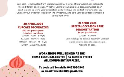
240427: Oral History Workshops – 31st May – Free – RSVP by 27th April
240423: Scarecrow Making Competition on 5th May: Nominations to be submitted by 23rd April
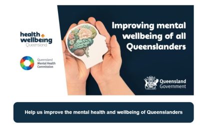
240502: Queensland Mental Health and Wellbeing Strategy Workshop – Roma Explorers Inn – 2nd May
You are invited to help shape a Queensland Mental Health and Wellbeing Strategy, which will focus on what keeps us well and improves community mental health and wellbeing in our state. Health and Wellbeing Queensland is leading the development of the Strategy in...