
Google Map: Apex Park
Parks
Campbells Dam
Campbells Dam - 44425 Warrego Highway Google Map: Campbells Dam
Clearview Rise Park – between Currey and Hanly Streets
Please click on link below: Clearview Rise aerial
Lions Park situated between Powell and Elmer Streets and Watson and Rayner Streets
Google Map: Lions Park
Railway Dam
Railway Dam - Off Mayne Street Google Map: Railway Dam
Shady’s Lagoon – Charles Street (between Bungil and George Streets)
Google Map: Shady's Lagoon
Skate and Bike Park – McDowall Street (between Cottell and Currey Streets)
Google Map: Skate and Bike Park
The Big Rig – 2 Riggers Road (off Warrego Highway – eastern entrance to town)
Tourist Information Centre, Park, Play Equipment, BBQ's, Night Show, Museum The Roma Big Rig and Visitor Information Centre is open, 7 days a week, from 9am-5pm. Council’s tourism staff and Visit Roma volunteers are available to share information and local tips...
Recent Updates
240508: Roma Show Fashion Parade Gala – Wednesday 8th May 6.30 pm
Roma Show Fashion Parade Gala Facebook Event Roma Show Society annual Fashion Parade Gala. Featuring local fashion houses. Nibbles and drink on arrival. Cash bar available. Lucky door prizes. Tickets $25 at the door or available on Eventbrite.

240712: Ladies Who Long Lunch – Western Qld Spirit – 12 pm Friday 12th July
Ladies Who Long Lunch Facebook Event Ladies Who Long Lunch Facebook Page The next Regional Long Lunch event will be held in July 2024 at the Western Spirit Queensland Gin Distillery, just outside of Roma. Women in business, entrepreneurs, professionals, aspiring...

240512: Mother’s Day Classic – Sunday 12th May
Mother's Day Classic - Facebook Page other’s Day is not too far away and we are busy behind the scenes getting ready for the fabulous MDC local event here in Roma! More details to come soon on the exciting events we have in store…stay tuned! You can...
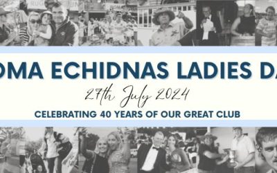
240724: Roma Echidna’s Ladies Day – Saturday 27th July
Roma Echidna's Ladies Day - Facebook Event Please join us for Roma Echidna's Ladies Day 2024! This year marks the 40th anniversary of Roma Echidnas, a special occasion to honour the women of our club and their contributions to both Roma Echidnas and the local...